
 Continue with onX Maps
 Continue with Facebook


 Difficult
Difficult
Difficult
 Difficult
Local Club: Shenandoah Valley Bicycle Coalition
Feb 28, 2024: 30+ Years of Partnership at the Massanutten Western Slope
Feb 26, 2024: Action Alert – Safer Bicycling
Feb 17, 2024: The Future of the Western Slope
Land Manager: USFS - George Washington & Jefferson National Forests
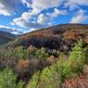
 Lookout Mountain from Stokesville
8.8 mi 14.2 km • 1,398' Up 426.26 m Up • 1,441' Down 439.36 m Down

 Bridgew…, VA
 Virginia Endurance Series SVBC Project Showcase Ride / Route
45.9 mi 73.8 km • 5,023' Up 1531.08 m Up • 5,075' Down 1546.93 m Down
Bridgew…, VA
Reddish Knob to Wild Oak: Chestnut & Grindstone Ridge Shuttle
13.3 mi 21.4 km • 975' Up 297.29 m Up • 3,733' Down 1137.82 m Down
Montgomery Hall Park trails
4.1 mi 6.7 km • 471' Up 143.49 m Up • 475' Down 144.83 m Down
 RockStar TRAIL Route
282.3 mi 454.3 km • 29,125' Up 8877.4 m Up • 29,507' Down 8993.64 m Down
Harriso…, VA
Spruce Knob to Seneca Creek - IMBA EPIC
17.6 mi 28.4 km • 1,944' Up 592.49 m Up • 1,950' Down 594.21 m Down


3 Comments