
 Continue with onX Maps
 Continue with Facebook


 Intermediate


 Intermediate
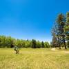
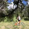
Local Club: Taos Mountain Bike Association (TMBA)
Feb 10, 2024: 2024 Film Festival : FREE Admission
Oct 3, 2023: Become a TMBA Member, Support Trails and Enter to Win Prizes All at Once!
Jul 23, 2023: Thanks for Standing Up for Trails
Land Manager: USFS - Carson National Forest
 Sierra de Don Fernando
4.6 mi 7.4 km • 530' Up 161.48 m Up • 533' Down 162.54 m Down
Angel Fire Valley Scenic Trails Loop
5.2 mi 8.3 km • 527' Up 160.57 m Up • 527' Down 160.69 m Down
Angel Fire, NM
 Big Kahuna Ride
21.1 mi 33.9 km • 2,527' Up 770.35 m Up • 2,535' Down 772.76 m Down
Sage to Elliot Barker Loop
16.9 mi 27.3 km • 2,066' Up 629.73 m Up • 2,066' Down 629.65 m Down
 South Boundary BigRide Course - 2017
41.0 mi 66.0 km • 4,280' Up 1304.48 m Up • 5,827' Down 1775.96 m Down
Angel Fire, NM
Woodpile
17.3 mi 27.8 km • 2,486' Up 757.79 m Up • 2,486' Down 757.66 m Down


2 Comments