
 Continue with onX Maps
 Continue with Facebook


 Difficult

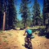
“A technically challenging trail with fantastic views and some steep climbs. ”


13.6
Miles21.8
KMSingletrack
 Difficult
Local Club: Tahoe Area Mountain Biking Association (TAMBA)
Jan 30, 2024: TAMBA Trail Legends: Fish Family
Dec 11, 2023: TAMBA Trail Legends: John Clausen
Nov 9, 2023: Alpenglow Winter Speaker Series: Michelle Parker’s ‘A Shift in Perspective’
Land Manager: USFS - Tahoe National Forest Office
 Rose to Toads
65.3 mi 105.0 km • 9,100' Up 2773.79 m Up • 11,390' Down 3471.72 m Down
 Incline…, NV
 TRT-Flume-Chimney Beach Exit
19.6 mi 31.6 km • 1,119' Up 341.13 m Up • 3,360' Down 1024.21 m Down
 Incline…, NV
Kings Beach Long Loop
Incline…, NV
Kings Beach Long Loop
10.3 mi 16.6 km • 1,537' Up 468.37 m Up • 1,555' Down 473.85 m Down
 Ash Canyon Trails
6.4 mi 10.2 km • 895' Up 272.89 m Up • 895' Down 272.74 m Down
Carson…, NV
 Jackass Ridge
10.9 mi 17.6 km • 1,446' Up 440.59 m Up • 1,452' Down 442.64 m Down
Truckee, CA
 Antone Meadows loop
8.6 mi 13.8 km • 491' Up 149.79 m Up • 488' Down 148.73 m Down
Dollar…, CA


1 Comment